


Five busy roads, two tube lines, twenty eight different bus routes and the overground railiway converge at the Elephant and Castle roundabout which sits on the fringe of the central London Congestion Zone and cycle superhighway*. It is complicated ensuring all these users get around without getting clogged up or crashing into each other. The subways provide precious extra space but they are not as useful as they could be because the signage guiding pedestrians around is woefully inadequate and inaccurate. This campaign wants the subways improved to make navigation much easier with new signage and other wayfinding initiatives. But we can't wait for someone else to sort this out so on 2 December 2012 we launched a brand new pedestrian map to replace everything currently available from Transport for London.
The new S.O.S. Elephant and Castle Pedestrian Map. Download your copy here.
Download our bespoke pedestrian friendly map of the Elephant and Castle Roundabout here.
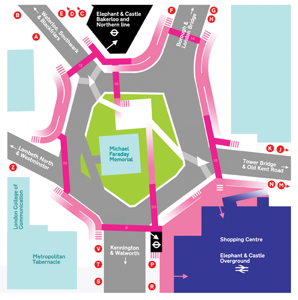
Elephant and Castle's seven subways (dark pink) are configured as the five sides of a pentagon with the roundabout at the centre. Gentle ramps and staircases (pale pink) take you from street level (white) into cuttings that connect the subways together. Two other subways take pedestrians back to ground level in the centre of the roundabout to a small park area with benches and floral guerrilla gardens.
The few maps on display at street since the early 1990s do not convey this arrangement accurately. The other very wordy signage is riddled with errors.

© Save Our Subways 2012 - 2014